The Phanerozoic Time-scale was published by the Geological Society in I964. It was also issued as a supplementary volume (12os) of the Quarterly Journal of the Geological Society. This volume is a supplement to it. It is in two parts. Part I contains four papers and 67 items numbered 338-4o 4 in continuation of items 1-337 in The Phanerozoic Time-scale. The alphabetic index to the items refers to all the items in both volumes. Part 2 is a paper by P. Evans which, by treating the Pleistocene time-scale, supplements The Phanerozoic Time-scale by extending its range. After the publication of The Phanerozoic Time-scale and The Fossil Record it was decided to reconstitute them as the first two volumes in a series of Special Publications of the Geological Society. Time and Place in Orogeny then appeared as Special Publication no. 3. Its related compilation Data for Orogenic Studies is in preparation as Special Publication no. 4. This volume is thus Special Publication no. 5.
The Phanerozoic Time-scale was published by the Geological Society in I964. It was also issued as a supplementary volume (12os) of the Quarterly Journal of the Geological Society. This volume is a supplement to it. It is in two parts. Part I contains four papers and 67 items numbered 338-4o 4 in continuation of items 1-337 in The Phanerozoic Time-scale. The alphabetic index to the items refers to all the items in both volumes. Part 2 is a paper by P. Evans which, by treating the Pleistocene time-scale, supplements The Phanerozoic Time-scale by extending its range. After the publication of The Phanerozoic Time-scale and The Fossil Record it was decided to reconstitute them as the first two volumes in a series of Special Publications of the Geological Society. Time and Place in Orogeny then appeared as Special Publication no. 3. Its related compilation Data for Orogenic Studies is in preparation as Special Publication no. 4. This volume is thus Special Publication no. 5.
This concise handbook presents a summary of Earth's history over the past 4.5 billion years as well as a brief overview of contemporaneous events on the Moon, Mars and Venus. The authors have been at the forefront of chronostratigraphic research and initiatives to create an international geologic time scale for many years, and the charts in this book present the most up to date, international standard, as ratified by the International Commission on Stratigraphy and the International Union of Geological Sciences. This book is an essential reference for all geoscientists, including researchers, students, and petroleum and mining professionals. The presentation is non-technical and illustrated with numerous colour charts, maps and photographs.
This concise handbook presents a summary of Earth's history over the past 4.5 billion years as well as a brief overview of contemporaneous events on the Moon, Mars and Venus. The authors have been at the forefront of chronostratigraphic research and initiatives to create an international geologic time scale for many years, and the charts in this book present the most up to date, international standard, as ratified by the International Commission on Stratigraphy and the International Union of Geological Sciences. This book is an essential reference for all geoscientists, including researchers, students, and petroleum and mining professionals. The presentation is non-technical and illustrated with numerous colour charts, maps and photographs.
On May 20-21, 1998, a second conference to addressradioisotopes and theage oftheearth (RATE) met in San Diego, California. Six research scientists with specialized training in Geology, Geophysics, Astrophysics, and Physics met to report on research completed over the past year. They also discussed plans for future activities. The Institute for Creation Research (ICR), Answers in Genesis (AIG), and the Creation Research Society (CRS) are jointly sponsoring these conferences to develop and communicate an understanding of radioisotope data from a young-earth perspective. An initial approach taken by some of the investigators is to explore models for accelerated rates of decay of radioisotopes during Creation, the Fall, or the Flood. Several sources of data suggest that significant quantities of radioactive decay have occurred during the history of the earth and cosmos. The conventional age model assumes that this decay has occurred over billions of years at constant rates rather than in concentrated episodes over short periods of time. Some of theRATEresearchers believe other explanations that do not require accelerated decay may be the answer, such as the geochemical distribution of elements.
On May 20-21, 1998, a second conference to addressradioisotopes and theage oftheearth (RATE) met in San Diego, California. Six research scientists with specialized training in Geology, Geophysics, Astrophysics, and Physics met to report on research completed over the past year. They also discussed plans for future activities. The Institute for Creation Research (ICR), Answers in Genesis (AIG), and the Creation Research Society (CRS) are jointly sponsoring these conferences to develop and communicate an understanding of radioisotope data from a young-earth perspective. An initial approach taken by some of the investigators is to explore models for accelerated rates of decay of radioisotopes during Creation, the Fall, or the Flood. Several sources of data suggest that significant quantities of radioactive decay have occurred during the history of the earth and cosmos. The conventional age model assumes that this decay has occurred over billions of years at constant rates rather than in concentrated episodes over short periods of time. Some of theRATEresearchers believe other explanations that do not require accelerated decay may be the answer, such as the geochemical distribution of elements.
Jurassic Geology of the World. By ArkellW. J.. 1956. Oliver and Boyd, Edinburgh, pp. 806, 28 tables, 102 text-figures, 46 plates. - Volume 94 Issue 4 - N. F. H.
Jurassic Geology of the World. By ArkellW. J.. 1956. Oliver and Boyd, Edinburgh, pp. 806, 28 tables, 102 text-figures, 46 plates. - Volume 94 Issue 4 - N. F. H.
It may be hard to believe that the Earth, with all the complexity and biodiversity we observe today, originated in a cloud of gas and dust. Yet much of the plant and animal life that seems so common now evolved relatively recently on the timeline of Earths long history. The Earths remarkable origins are chronicled in this insightful volume, which also examines the prehistoric organismsfrom bacteria to dinosaursthat populated the planet long before humans arrived.
It may be hard to believe that the Earth, with all the complexity and biodiversity we observe today, originated in a cloud of gas and dust. Yet much of the plant and animal life that seems so common now evolved relatively recently on the timeline of Earths long history. The Earths remarkable origins are chronicled in this insightful volume, which also examines the prehistoric organismsfrom bacteria to dinosaursthat populated the planet long before humans arrived.
Historical Geology provides up-to-date and expanded coverage of the metamorphic span of Earth's history as told through its fossils, rocks, and species, from the very origins of the planet to the current Holocene interglacial period. An introductory chapter details basic geologic concepts, followed by chapters - organized according to different geologic time periods - that chronicle the emergence of each successive group of plants and animals.
Historical Geology provides up-to-date and expanded coverage of the metamorphic span of Earth's history as told through its fossils, rocks, and species, from the very origins of the planet to the current Holocene interglacial period. An introductory chapter details basic geologic concepts, followed by chapters - organized according to different geologic time periods - that chronicle the emergence of each successive group of plants and animals.
HISTORICAL GEOLOGY, Sixth Edition, presents a balanced overview of the geological and biological history of Earth as a continuum of interrelated events that reflect the underlying principles and processes that have shaped our planet. Students are taught the basic geologic principles as well as how scientists apply these principles to unravel Earth's history. Three major themes - time, evolutionary theory, and plate tectonics - are woven together throughout the book to help students link essential material and enhance their understanding of historical geology. The sixth edition has been thoroughly updated to include the formation of the Earth-Moon system, information about the evolution of populations as a whole, and coverage of climate change throughout the text, placing an emphasis on what we don't know within the historical geology field as compared to what we do know.
HISTORICAL GEOLOGY, Sixth Edition, presents a balanced overview of the geological and biological history of Earth as a continuum of interrelated events that reflect the underlying principles and processes that have shaped our planet. Students are taught the basic geologic principles as well as how scientists apply these principles to unravel Earth's history. Three major themes - time, evolutionary theory, and plate tectonics - are woven together throughout the book to help students link essential material and enhance their understanding of historical geology. The sixth edition has been thoroughly updated to include the formation of the Earth-Moon system, information about the evolution of populations as a whole, and coverage of climate change throughout the text, placing an emphasis on what we don't know within the historical geology field as compared to what we do know.
This book presents an integrated approach to the study of the evolution of the Archean lithosphere, biosphere and atmosphere, and as such it is a unique contribution to our understanding of the early Earth and life. The structural and geochemical make-up of both the oceanic and continental crust of the Archean Earth is documented in some case studies of various cratons, and the implications of the Phanerozoic plate and plume tectonic processes for the Archean geology are discussed in several chapters in the book. All chapters are process-oriented and data-rich, and reflect the most recent knowledge and information on the Archean Earth. The interdisciplinary approach of examining the evolution of the Archean crust, oceans, and life that we adopt in this book sets it apart from previous publications on Precambrian geology.
The book will be attractive to researchers in academia and in industry, and to senior undergraduate students, graduate students and faculty in earth and natural sciences.
With the growing recognition during the last two centuries that the Earth has an immense age and processes over long periods of time have changed the morphology and composition of the Earth's crust, geologists have become increasingly interested in determination of absolute ages. A rela tive geochronology was established on the basis of the lithostratigraphic and biostratigraphic principles developed during the last century. With the discovery of radioactivity, the basis for a new geoscientific discipline - geochronology - was established (Rutherford 1906). It is the study of geological time, based mainly on the time signatures provided by the isotopic composition in geologic materials. The isotopic signature in a rock yields more information than that provided by the geochemical signature alone because it reflects the origin and history of the element in the rock. The aim of geochronology is to calibrate and standardize chronostrati graphic scales, to develop geological time scales that have a sensitive or at least useful resolution in order to place the geological events in the correct chronological order, and to assign their proper time spans. In practice, the application of geochronology is much wider because the data in the "natural archives" often provide information on the origin, genesis, and history of the materials. This, of course, requires an understanding of the geochemical behavior of the substances involved.
With the growing recognition during the last two centuries that the Earth has an immense age and processes over long periods of time have changed the morphology and composition of the Earth's crust, geologists have become increasingly interested in determination of absolute ages. A rela tive geochronology was established on the basis of the lithostratigraphic and biostratigraphic principles developed during the last century. With the discovery of radioactivity, the basis for a new geoscientific discipline - geochronology - was established (Rutherford 1906). It is the study of geological time, based mainly on the time signatures provided by the isotopic composition in geologic materials. The isotopic signature in a rock yields more information than that provided by the geochemical signature alone because it reflects the origin and history of the element in the rock. The aim of geochronology is to calibrate and standardize chronostrati graphic scales, to develop geological time scales that have a sensitive or at least useful resolution in order to place the geological events in the correct chronological order, and to assign their proper time spans. In practice, the application of geochronology is much wider because the data in the "natural archives" often provide information on the origin, genesis, and history of the materials. This, of course, requires an understanding of the geochemical behavior of the substances involved.
A successor to A Geologic Time Scale 1989 (Cambridge, 1990), this volume introduces the theory and methodology behind the construction of the new time scale, before presenting the scale itself in extensive detail. An international team of over forty stratigraphic experts develops the most up-to-date international stratigraphic framework for the Precambrian and Phanerozoic eras. A large wallchart (not available for eBook) summarizing the time scale at the back of the book completes this invaluable reference for researchers and students.
A successor to A Geologic Time Scale 1989 (Cambridge, 1990), this volume introduces the theory and methodology behind the construction of the new time scale, before presenting the scale itself in extensive detail. An international team of over forty stratigraphic experts develops the most up-to-date international stratigraphic framework for the Precambrian and Phanerozoic eras. A large wallchart (not available for eBook) summarizing the time scale at the back of the book completes this invaluable reference for researchers and students.
This text provides a reference for all subdisciplines of the earth sciences. Subjects can be accessed in varying levels of detail - the longer entries provide general overviews and the short entries provide specific details in more specialized areas. Thus, there is a general section on seismology, and 25 further entries which consider more specifically topics such as seismic creep, seismic head wave, seismic refraction and so on. The encyclopaedia covers geophysics, palaeontology and stratigraphy, mineralogy, geochemistry, vulcanology and magnetism, igneous and metamorphic rocks, sedimentology, geomorphology and environmental geology, structural geology, and economic geology. In addition smaller subjects such as the history of geology, mapping, archaeological geology and mathematical geology are covered in separate essays. In total there are 2752 cross-referenced entries. Each keyword is accompanied by synonyms if there is more than one common term for it, and all keywords appear in the index which contains 7979 entries.
This text provides a reference for all subdisciplines of the earth sciences. Subjects can be accessed in varying levels of detail - the longer entries provide general overviews and the short entries provide specific details in more specialized areas. Thus, there is a general section on seismology, and 25 further entries which consider more specifically topics such as seismic creep, seismic head wave, seismic refraction and so on. The encyclopaedia covers geophysics, palaeontology and stratigraphy, mineralogy, geochemistry, vulcanology and magnetism, igneous and metamorphic rocks, sedimentology, geomorphology and environmental geology, structural geology, and economic geology. In addition smaller subjects such as the history of geology, mapping, archaeological geology and mathematical geology are covered in separate essays. In total there are 2752 cross-referenced entries. Each keyword is accompanied by synonyms if there is more than one common term for it, and all keywords appear in the index which contains 7979 entries.
A best-selling resource for all industry personnel. This helpful reference contains over 12,000 definitions of terms used in petroleum geology, exploration, drilling, production, pipelining, processing, refining, accounting, and marketing. Features over 540 2-color illustrations and an easy-to-use format. Also includes contact information for industry associations and key government agencies and lists of common abbreviations, SI units, and metric equivalents.
A best-selling resource for all industry personnel. This helpful reference contains over 12,000 definitions of terms used in petroleum geology, exploration, drilling, production, pipelining, processing, refining, accounting, and marketing. Features over 540 2-color illustrations and an easy-to-use format. Also includes contact information for industry associations and key government agencies and lists of common abbreviations, SI units, and metric equivalents.
Since it was published in 1962,Gemshas become universally recognized as the most comprehensive and authoritative treatise on gem materials in the English language. Now in its sixth edition, it has been revised for relevance to today’s practice. It includes an expanded encyclopaedic section, and offers a descriptive account of all gem materials used as ornament, along with their synthetic counterparts and the materials used over the centuries to imitate them. Editor Michael O’Donoghue has been assisted by a team of specialists to make this sixth edition ofGemsan invaluable gemmological reference work which caters for professional jewelers, student gemmologists, and collectors of gems alike.
Since it was published in 1962,Gemshas become universally recognized as the most comprehensive and authoritative treatise on gem materials in the English language. Now in its sixth edition, it has been revised for relevance to today’s practice. It includes an expanded encyclopaedic section, and offers a descriptive account of all gem materials used as ornament, along with their synthetic counterparts and the materials used over the centuries to imitate them. Editor Michael O’Donoghue has been assisted by a team of specialists to make this sixth edition ofGemsan invaluable gemmological reference work which caters for professional jewelers, student gemmologists, and collectors of gems alike.
SinceGemmologywas published, readers have used it to gain an in-depth appreciation of the science of gemmology, its history, and practice. This third edition has been completely revised to cover the latest methods of gem enhancement and identification, as well as the latest test instruments and laboratory techniques.Gemmologyserves as an invaluable reference guide for gemmologists, professionals, and students, and is an invaluable text for anyone in the gemmological profession. Also included are details of the Gemmological Association’s Foundation Course together with advice on examination techniques.
SinceGemmologywas published, readers have used it to gain an in-depth appreciation of the science of gemmology, its history, and practice. This third edition has been completely revised to cover the latest methods of gem enhancement and identification, as well as the latest test instruments and laboratory techniques.Gemmologyserves as an invaluable reference guide for gemmologists, professionals, and students, and is an invaluable text for anyone in the gemmological profession. Also included are details of the Gemmological Association’s Foundation Course together with advice on examination techniques.
Most high-temperature geothermal resources develop in volcanic regions, but very few have been successfully explored and developed despite the ever-growing need for renewable energy resources. This is particularly true of the many developing countries that exist in volcanic regions with potential geothermal resources. Because exploration techniques, which must be adapted from the oil industry, are expensive and uncertain, economic growth in these countries remains contingent on the availability and cost of oil.
Bridging the gap between academic geologists and drilling engineers,Volcanology and Geothermal Energyis a practical and thorough guide to planning and operating a successful exploration project. It describes the potential geothermal reservoirs associated with volcanoes and volcanic regions and uses recent advances in volcanology to offer many examples of how geological field data give evidence of the location, nature, and size of a geothermal resource.
'Volcanoes' examines the different types of volcanic eruptions. It starts with an introduction to volcanoes, volcanic landforms and plate tectonics, and includes classification of igneous rocks, the hazards associated with volcanism, and the prediction of eruptions.
'Volcanoes' examines the different types of volcanic eruptions. It starts with an introduction to volcanoes, volcanic landforms and plate tectonics, and includes classification of igneous rocks, the hazards associated with volcanism, and the prediction of eruptions.
Volcanic rocks are important in compiling geological records because of their characteristic chemistry, relatively fast accumulation and great variety; however, recognizable facies diversity may be useful for reconstructing not only the volcanic processes but also the eruptive environment where the volcanism take place. Volcanic rocks that are significantly fragmented are important from a stratigraphic point of view and they can be used to study palaeoenvironments where these volcanic deposits formed. The increasing importance of fragmental volcanic rocks in geological research is clearly demonstrated by the increasing number of publications that have appeared over recent decades dealing with volcaniclastic deposits and rocks. Different volcanological schools and associated textbooks have been published since the 1980s. Among the many that have become available four are of particular significance These are Fisher and Schmincke(1984): Pyroclastic Rocks; CAS and WRIGHT (1987) Volcanic Successions; MCPHIE et al. (1993) Volcanic Textures; and SIGURDSSON et al (2000) Encyclopedia of Volcanoes.
Volcanic rocks are important in compiling geological records because of their characteristic chemistry, relatively fast accumulation and great variety; however, recognizable facies diversity may be useful for reconstructing not only the volcanic processes but also the eruptive environment where the volcanism take place. Volcanic rocks that are significantly fragmented are important from a stratigraphic point of view and they can be used to study palaeoenvironments where these volcanic deposits formed. The increasing importance of fragmental volcanic rocks in geological research is clearly demonstrated by the increasing number of publications that have appeared over recent decades dealing with volcaniclastic deposits and rocks. Different volcanological schools and associated textbooks have been published since the 1980s. Among the many that have become available four are of particular significance These are Fisher and Schmincke(1984): Pyroclastic Rocks; CAS and WRIGHT (1987) Volcanic Successions; MCPHIE et al. (1993) Volcanic Textures; and SIGURDSSON et al (2000) Encyclopedia of Volcanoes.
Fundamentals of Physical Volcanology is a comprehensive overview of the processes that control when and how volcanoes erupt. Understanding these processes involves bringing together ideas from a number of disciplines, including branches of geology, such as petrology and geochemistry; and aspects of physics, such as fluid dynamics and thermodynamics.
This book explains in accessible terms how different areas of science have been combined to reach our current level of knowledge of volcanic systems. It includes an introduction to eruption types, an outline of the development of physical volcanology, a comprehensive overview of subsurface processes, eruption mechanisms, the nature of volcanic eruptions and their products, and a review of how volcanoes affect the environment.
Fundamentals of Physical Volcanology is essential reading for undergraduate students in earth science.
Every engineering structure, whether it's a building, bridge or road, is affected by the ground on which it is built. Geology is of fundamental importance when deciding on the location and design of all engineering works, and it is essential that engineers have a basic knowledge of the subject.
Engineering Geology introduces the fundamentals of the discipline and ensures that engineers have a clear understanding of the processes at work, and how they will impact on what is to be built. Core areas such as stratigraphy, rock types, structures and geological processes are explained, and put in context. The basics of soil mechanics and the links between groundwater conditions and underlying geology are introduced.
As well as the theoretical knowledge necessary, Professor Bell introduces the techniques that engineers will need to learn about and understand the geological conditions in which they intend to build. Site investigation techniques are detailed, and the risks and risk avoidance methods for dealing with different conditions are explained.
* Accessible introduction to geology for engineers * Key points illustrated with diagrams and photographs * Teaches the impact of geology on the planning and design of structures
Professionals and students in any geology-related field will find this an essential reference. It clearly and systematically explains underground engineering geology principles, methods, theories and case studies. The authors lay out engineering problems in underground rock engineering and how to study and solve them. The book specially emphasizes mechanical and hydraulic couplings in rock engineering for wellbore stability, mining near aquifers and other underground structures where inflow is a problem.
Professionals and students in any geology-related field will find this an essential reference. It clearly and systematically explains underground engineering geology principles, methods, theories and case studies. The authors lay out engineering problems in underground rock engineering and how to study and solve them. The book specially emphasizes mechanical and hydraulic couplings in rock engineering for wellbore stability, mining near aquifers and other underground structures where inflow is a problem.
The Engineering Geology Field Manual presents the practices for the collection of geologic data obtained by the Bureau of Reclamation. The manual establishes common guidelines, procedures, and concepts for the collection, evaluation, and presentation of geologic information. The analysis of geologic conditions, the preparation of designs and specifications, and effective construction monitoring and us of geological information to assess site characteristics and risk, require consistent, comprehensive, and timely geologic information. The use of these guidelines by all Reclamation engineering geologists collecting, documenting, evaluationg, and presenting geological and geotechnical data promotes consistency, helps assure that the required evaluations and data are complete, and promotes the inegration and coordination of geological and engineering activites.
The Engineering Geology Field Manual presents the practices for the collection of geologic data obtained by the Bureau of Reclamation. The manual establishes common guidelines, procedures, and concepts for the collection, evaluation, and presentation of geologic information. The analysis of geologic conditions, the preparation of designs and specifications, and effective construction monitoring and us of geological information to assess site characteristics and risk, require consistent, comprehensive, and timely geologic information. The use of these guidelines by all Reclamation engineering geologists collecting, documenting, evaluationg, and presenting geological and geotechnical data promotes consistency, helps assure that the required evaluations and data are complete, and promotes the inegration and coordination of geological and engineering activites.
This text is directed at the heart of Engineering Geology where geology is used to identify potential problems arising from ground conditions. It describes how to investigate those conditions and to define an engineering response that will either avoid or reduce or even eliminate the problems revealed. The book presents the "big picture" that is so often lacking when only site details are available, but necessary for adequate engineering solutions.
This text is directed at the heart of Engineering Geology where geology is used to identify potential problems arising from ground conditions. It describes how to investigate those conditions and to define an engineering response that will either avoid or reduce or even eliminate the problems revealed. The book presents the "big picture" that is so often lacking when only site details are available, but necessary for adequate engineering solutions.
It is more than half a century since the publication of R. A. Bagnold’s classic book The physics of blown sand and desert dunes, and it is a tribute to the quality of Bagnold’s work that many of the fundamental principles which he developed - main valid today. His book continues to be essential reading for any serious s- dent of aeolian processes. However, the past two decades have seen an explosion in the scale of research dealing with aeolian transport processes, sediments, and landforms. Some of this work has been summarized in review papers and edited conference proceedings, but this book provides the rst attempt to review the whole eld of aeolian sand research. Inevitably, it has not been possible to cover all - pects in equal depth, and the balance of included material naturally re ects the - thors’ own interests to a signi cant degree. However, our aim has been to provide as broad a perspective as possible, and to provide an entry point to an extensive mul- disciplinary scienti c literature, some of which has not been given the attention it deserves in earlier textbooks and review papers. Many examples are drawn from existing published work, but the book also makes extensive use of our own research in the Middle East, Australia, Europe, and North America. The book has been written principally for use by advanced undergraduates, po- graduates, and more senior research workers in geomorphology and sedimentology.
It is more than half a century since the publication of R. A. Bagnold’s classic book The physics of blown sand and desert dunes, and it is a tribute to the quality of Bagnold’s work that many of the fundamental principles which he developed - main valid today. His book continues to be essential reading for any serious s- dent of aeolian processes. However, the past two decades have seen an explosion in the scale of research dealing with aeolian transport processes, sediments, and landforms. Some of this work has been summarized in review papers and edited conference proceedings, but this book provides the rst attempt to review the whole eld of aeolian sand research. Inevitably, it has not been possible to cover all - pects in equal depth, and the balance of included material naturally re ects the - thors’ own interests to a signi cant degree. However, our aim has been to provide as broad a perspective as possible, and to provide an entry point to an extensive mul- disciplinary scienti c literature, some of which has not been given the attention it deserves in earlier textbooks and review papers. Many examples are drawn from existing published work, but the book also makes extensive use of our own research in the Middle East, Australia, Europe, and North America. The book has been written principally for use by advanced undergraduates, po- graduates, and more senior research workers in geomorphology and sedimentology.
In addition to providing information about ancient environments and macroevolution, microfossils can be used to correlate the absolute ages of rocks. Following the development of biostratigraphy from classical origins into petroleum exploration and deep-ocean drilling, this survey explores in depth the surprisingly wide application of biostratigraphic methods. The book will be essential reading for students and researchers working in basin analysis, sequence stratigraphy, palaeoceanography, palaeobiology and related fields.
In addition to providing information about ancient environments and macroevolution, microfossils can be used to correlate the absolute ages of rocks. Following the development of biostratigraphy from classical origins into petroleum exploration and deep-ocean drilling, this survey explores in depth the surprisingly wide application of biostratigraphic methods. The book will be essential reading for students and researchers working in basin analysis, sequence stratigraphy, palaeoceanography, palaeobiology and related fields.
Sequence Stratigraphy is a branch of geology that attempts to subdivide and link sedimentary deposits into unconformity bound units on a variety of scales and explain these stratigraphic units in terms of variations in sediment supply and variations in the rate of change in accommodation space (often associated with changes in relative sea level). The essence of the method is mapping of strata based on identification of surfaces which are assumed to represent time lines (e.g. subaerial unconformities, maximum flooding surfaces), and therefore placing stratigraphy in chronostratigraphic framework. Sequence stratigraphy is a useful alternative to a lithostratigraphic approach, which emphasizes similarity of the lithology of rock units rather than time significance.
Sequence Stratigraphy is a branch of geology that attempts to subdivide and link sedimentary deposits into unconformity bound units on a variety of scales and explain these stratigraphic units in terms of variations in sediment supply and variations in the rate of change in accommodation space (often associated with changes in relative sea level). The essence of the method is mapping of strata based on identification of surfaces which are assumed to represent time lines (e.g. subaerial unconformities, maximum flooding surfaces), and therefore placing stratigraphy in chronostratigraphic framework. Sequence stratigraphy is a useful alternative to a lithostratigraphic approach, which emphasizes similarity of the lithology of rock units rather than time significance.
Stratigraphy has come to be indispensable to nearly all branches of the earth sciences, assisting such endeavors as charting the course of evolution, understanding ancient ecosystems, and furnishing data pivotal to finding strategic mineral resources. This book focuses on traditional and innovative stratigraphy techniques and how these can be used to reconstruct the geological history of sedimentary basins and in solving manifold geological problems and phenomena.
Stratigraphy has come to be indispensable to nearly all branches of the earth sciences, assisting such endeavors as charting the course of evolution, understanding ancient ecosystems, and furnishing data pivotal to finding strategic mineral resources. This book focuses on traditional and innovative stratigraphy techniques and how these can be used to reconstruct the geological history of sedimentary basins and in solving manifold geological problems and phenomena.
Paleoecology (also spelt palaeoecology) uses data from fossils and subfossils to reconstruct the ecosystems of the past. It involves the study of fossil organisms and their associated remains (such as shells, teeth, pollen, and seeds), which can help in the interpretation of their life cycle, living interactions, natural environment, communities, and manner of death and burial. Such interpretations aid the reconstruction of past environments (paleoenvironments).
Paleoecologists have studied the fossil record to try to clarify the relationship animals have to their environment, in part to help understand the current state of biodiversity. They have identified close links between vertebrate taxonomic and ecological diversity, that is, between the diversity of animals and the niches they occupy.
This revised edition features a systematic treatment of Earth history, rock types, marine fossils, terrestrial fossils, crystals, gems, and precious metals that provides insights into Earth's character, as well as looking at such topics as global tectonics and faunal extinctions.
Download
This revised edition features a systematic treatment of Earth history, rock types, marine fossils, terrestrial fossils, crystals, gems, and precious metals that provides insights into Earth's character, as well as looking at such topics as global tectonics and faunal extinctions.
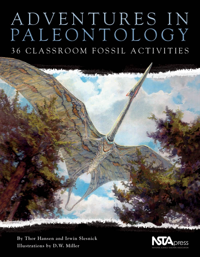
Millions of years after vanishing from the Earth, dinosaurs still have the power to stir students' curiosity. Deepen that interest with Adventures in Paleontology, a series of lively hands-on activities especially for middle schoolers. This beautifully illustrated full color book features 36 activities that open students up to a variety of foundational sciences, including biology, geology, chemistry, physics, and astronomy. For example: 'How Do Fossils Form?' discusses how organisms become fossils and illustrates the concept with activities that simulate fossil-making processes. 'What Can You Learn From Fossils?' explores what fossils teach about ancient organisms. 'Mass Extinction and Meteor Collisions With Earth' discusses recently discovered links between meteor and asteroid impacts on Earth and the demise of animals like dinosaurs. Other chapters cover how to tell the age of the Earth; how dinosaurs evolved; and diversity, classification, and taxonomy.! The final chapters offer humanistic perspectives on fossils in literature and art. As an attention-grabbing complement to the text, vivid full color illustrations show not just skeletons and animal tracks but also what dinosaurs probably looked like in their natural settings. Handy line drawings guide students through each step of the activities.
Millions of years after vanishing from the Earth, dinosaurs still have the power to stir students' curiosity. Deepen that interest with Adventures in Paleontology, a series of lively hands-on activities especially for middle schoolers. This beautifully illustrated full color book features 36 activities that open students up to a variety of foundational sciences, including biology, geology, chemistry, physics, and astronomy. For example: 'How Do Fossils Form?' discusses how organisms become fossils and illustrates the concept with activities that simulate fossil-making processes. 'What Can You Learn From Fossils?' explores what fossils teach about ancient organisms. 'Mass Extinction and Meteor Collisions With Earth' discusses recently discovered links between meteor and asteroid impacts on Earth and the demise of animals like dinosaurs. Other chapters cover how to tell the age of the Earth; how dinosaurs evolved; and diversity, classification, and taxonomy.! The final chapters offer humanistic perspectives on fossils in literature and art. As an attention-grabbing complement to the text, vivid full color illustrations show not just skeletons and animal tracks but also what dinosaurs probably looked like in their natural settings. Handy line drawings guide students through each step of the activities.
Text and art portray over 100 prehistoric reptiles of land, sea, and air, including the reptiles that preceded the dinosaurs, the dinosaur giants of the Mesozoic Era, and the large reptiles of the age of mammals.
Text and art portray over 100 prehistoric reptiles of land, sea, and air, including the reptiles that preceded the dinosaurs, the dinosaur giants of the Mesozoic Era, and the large reptiles of the age of mammals.
A primary goal of geomorphological enquiry is to make genetic associations between process and form. In rock breakdown studies, the links between process, inheritance and lithology are not well constrained. In particular, there is a need to establish an understanding of feature persistence. That is, to determine the extent to which in situ rock breakdown (e.g., aeolian abrasion or salt weathering) masks signatures of earlier geomorphic transport processes (e.g., fluvial transport or crater ejecta). Equally important is the extent to which breakdown during geomorphic transport masks the imprint of past weathering. The use of rock features in this way raises the important question: Can features on the surface of a rock reliably indicate its geomorphic history? This has not been determined for rock surfaces on Earth or other planets. A first step towards constraining the links between process, inheritance, and morphology is to identify pristine features produced by different process regimes. The purpose of this atlas is to provide a comprehensive image collection of breakdown features commonly observed on boulders in different geomorphic environments. The atlas is intended as a tool for planetary geoscientists and their students to assist in identifying features found on rocks on planetary surfaces. In compiling this atlas, we have attempted to include features that have formed 'recently' and where the potential for modification by another geomorphic process is low. However, we acknowledge that this is, in fact, difficult to achieve when selecting rocks in their natural environment. We group breakdown features according to their formative environment and process. In selecting images for inclusion in the atlas we were mindful to cover a wide range of climatic zones. For example, in the weathering chapter, clast features are shown from locations such as the hyper-arid polar desert of Antarctica and the semi-arid canyons of central Australia. This is important as some features (e.g., alveoli) occur across climate regimes. We have drawn on the published geomorphological literature and our own field experience. We use, where possible, images of extrusive igneous rocks as the data returned from Mars, Venus and the Moon indicates that this is the predominant rock type. One of the purposes of this atlas is to expand the range of surface features that are known to indicate a particular geomorphic environment or process history. The surface features on boulders in some environments such as aeolian and weathering are well understood. In contrast, those in fluvial or ejecta environments are not. Therefore we have presented a comprehensive assemblage of features that are likely to be produced in each of the geomorphic environments. We hope that this atlas will trigger more research on diagnostic features, particularly their morphometry and detailed morphology, their persistence and rates of formation. In this first edition of the atlas we detail the features found on clasts in three geomorphic environments: aeolian, fluvial and weathering. Future editions of the atlas will include chapters on ejecta, micro-impacts, coastal, colluvial, glacial and structural features.
A primary goal of geomorphological enquiry is to make genetic associations between process and form. In rock breakdown studies, the links between process, inheritance and lithology are not well constrained. In particular, there is a need to establish an understanding of feature persistence. That is, to determine the extent to which in situ rock breakdown (e.g., aeolian abrasion or salt weathering) masks signatures of earlier geomorphic transport processes (e.g., fluvial transport or crater ejecta). Equally important is the extent to which breakdown during geomorphic transport masks the imprint of past weathering. The use of rock features in this way raises the important question: Can features on the surface of a rock reliably indicate its geomorphic history? This has not been determined for rock surfaces on Earth or other planets. A first step towards constraining the links between process, inheritance, and morphology is to identify pristine features produced by different process regimes. The purpose of this atlas is to provide a comprehensive image collection of breakdown features commonly observed on boulders in different geomorphic environments. The atlas is intended as a tool for planetary geoscientists and their students to assist in identifying features found on rocks on planetary surfaces. In compiling this atlas, we have attempted to include features that have formed 'recently' and where the potential for modification by another geomorphic process is low. However, we acknowledge that this is, in fact, difficult to achieve when selecting rocks in their natural environment. We group breakdown features according to their formative environment and process. In selecting images for inclusion in the atlas we were mindful to cover a wide range of climatic zones. For example, in the weathering chapter, clast features are shown from locations such as the hyper-arid polar desert of Antarctica and the semi-arid canyons of central Australia. This is important as some features (e.g., alveoli) occur across climate regimes. We have drawn on the published geomorphological literature and our own field experience. We use, where possible, images of extrusive igneous rocks as the data returned from Mars, Venus and the Moon indicates that this is the predominant rock type. One of the purposes of this atlas is to expand the range of surface features that are known to indicate a particular geomorphic environment or process history. The surface features on boulders in some environments such as aeolian and weathering are well understood. In contrast, those in fluvial or ejecta environments are not. Therefore we have presented a comprehensive assemblage of features that are likely to be produced in each of the geomorphic environments. We hope that this atlas will trigger more research on diagnostic features, particularly their morphometry and detailed morphology, their persistence and rates of formation. In this first edition of the atlas we detail the features found on clasts in three geomorphic environments: aeolian, fluvial and weathering. Future editions of the atlas will include chapters on ejecta, micro-impacts, coastal, colluvial, glacial and structural features.
Where tectonic plates meet, the Earth’s crust becomes unstable as the plates slide past each other, push against each other, or ride under or over one another. Earthquakes and volcanic eruptions happen at the boundaries between plates. Magma (molten rock) is less dense than the crust. It can rise to the surface through weaknesses in the crust, forming a volcano.
Geologists study volcanoes to try to predict future eruptions. Volcanoes can be very destructive, but some people choose to live near them because volcanic soil is very fertile.
One of the purposes of an international congress devoted to natural or synthetic materials is to inform the researcher about the potential use of new physical techniques employed for characterizing these materials. This specific task is becoming more and more urgent because the number of physical techniques and their new applications are increasing very rapidly.Advanced Techniques for Clay Mineral Analysisaims to reach a larger community of scientists and to disseminate information about applications of physical techniques on more general basis. Some of the issues discussed in the book include modern developments of thermal methods analysis and of electron microscopy, Mössbauer spectroscopy, nuclear magnetic resonance, electron spin resonance, neutron scattering, and X-ray photoelectron spectroscopy.
One of the purposes of an international congress devoted to natural or synthetic materials is to inform the researcher about the potential use of new physical techniques employed for characterizing these materials. This specific task is becoming more and more urgent because the number of physical techniques and their new applications are increasing very rapidly.Advanced Techniques for Clay Mineral Analysisaims to reach a larger community of scientists and to disseminate information about applications of physical techniques on more general basis. Some of the issues discussed in the book include modern developments of thermal methods analysis and of electron microscopy, Mössbauer spectroscopy, nuclear magnetic resonance, electron spin resonance, neutron scattering, and X-ray photoelectron spectroscopy.