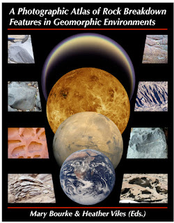
A Photographic Atlas of Rock Breakdown Features in Geomorphic Environments
https://blogger.googleusercontent.com/img/b/R29vZ2xl/AVvXsEgxmZ1zlxUisBeWaspccox0KUfiD5Xs0ndAwHaNEsa7fXEpa7dvtAwqQhRmq9VdEoz2O1Aam58Am2VYSXkWrzCrkDBsygphWiJFe5qw1jVBdzRgfiFwvcpx-BE4cSw8zfO_olSbLJ4pSksc/s72-c/a_photographic_atlas_of_rock_breakdown_features_in_geomorphic_environments.jpe
A primary goal of geomorphological enquiry is to make genetic associations between process and form. In rock breakdown studies, the links between process, inheritance and lithology are not well constrained. In particular, there is a need to establish an understanding of feature persistence. That is, to determine the extent to which in situ rock breakdown (e.g., aeolian abrasion or salt weathering) masks signatures of earlier geomorphic transport processes (e.g., fluvial transport or crater ejecta). Equally important is the extent to which breakdown during geomorphic transport masks the imprint of past weathering. The use of rock features in this way raises the important question: Can features on the surface of a rock reliably indicate its geomorphic history? This has not been determined for rock surfaces on Earth or other planets. A first step towards constraining the links between process, inheritance, and morphology is to identify pristine features produced by different process regimes. The purpose of this atlas is to provide a comprehensive image collection of breakdown features commonly observed on boulders in different geomorphic environments. The atlas is intended as a tool for planetary geoscientists and their students to assist in identifying features found on rocks on planetary surfaces. In compiling this atlas, we have attempted to include features that have formed 'recently' and where the potential for modification by another geomorphic process is low. However, we acknowledge that this is, in fact, difficult to achieve when selecting rocks in their natural environment. We group breakdown features according to their formative environment and process. In selecting images for inclusion in the atlas we were mindful to cover a wide range of climatic zones. For example, in the weathering chapter, clast features are shown from locations such as the hyper-arid polar desert of Antarctica and the semi-arid canyons of central Australia. This is important as some features (e.g., alveoli) occur across climate regimes. We have drawn on the published geomorphological literature and our own field experience. We use, where possible, images of extrusive igneous rocks as the data returned from Mars, Venus and the Moon indicates that this is the predominant rock type. One of the purposes of this atlas is to expand the range of surface features that are known to indicate a particular geomorphic environment or process history. The surface features on boulders in some environments such as aeolian and weathering are well understood. In contrast, those in fluvial or ejecta environments are not. Therefore we have presented a comprehensive assemblage of features that are likely to be produced in each of the geomorphic environments. We hope that this atlas will trigger more research on diagnostic features, particularly their morphometry and detailed morphology, their persistence and rates of formation. In this first edition of the atlas we detail the features found on clasts in three geomorphic environments: aeolian, fluvial and weathering. Future editions of the atlas will include chapters on ejecta, micro-impacts, coastal, colluvial, glacial and structural features.


Enregistrer un commentaire